Peaks and Valleys
Have you ever struggled and sweat your way up a mountain to reach the peak and stand atop the world? Have you felt the joy emanating from your body as you take in the view with warm sunlight cascading across the landscape? Have you stumbled down a mountain, falling to the bottom and felt the soul crushing defeat of looking up towards the next mountain you must climb? Have you felt the weight of gravity holding down your every step as you climb back up? Life is a path filled with peaks and valleys. You go up and down and you work your way back up again. That is the Appalachian Trail.

White Blaze — a rectangle of white paint two inches wide by six inches high placed on trees, rocks, and other surfaces to guide hikers along the Appalachian Trail. There are approximately 165,000 white blazes throughout the entire length of the Appalachian Trail.
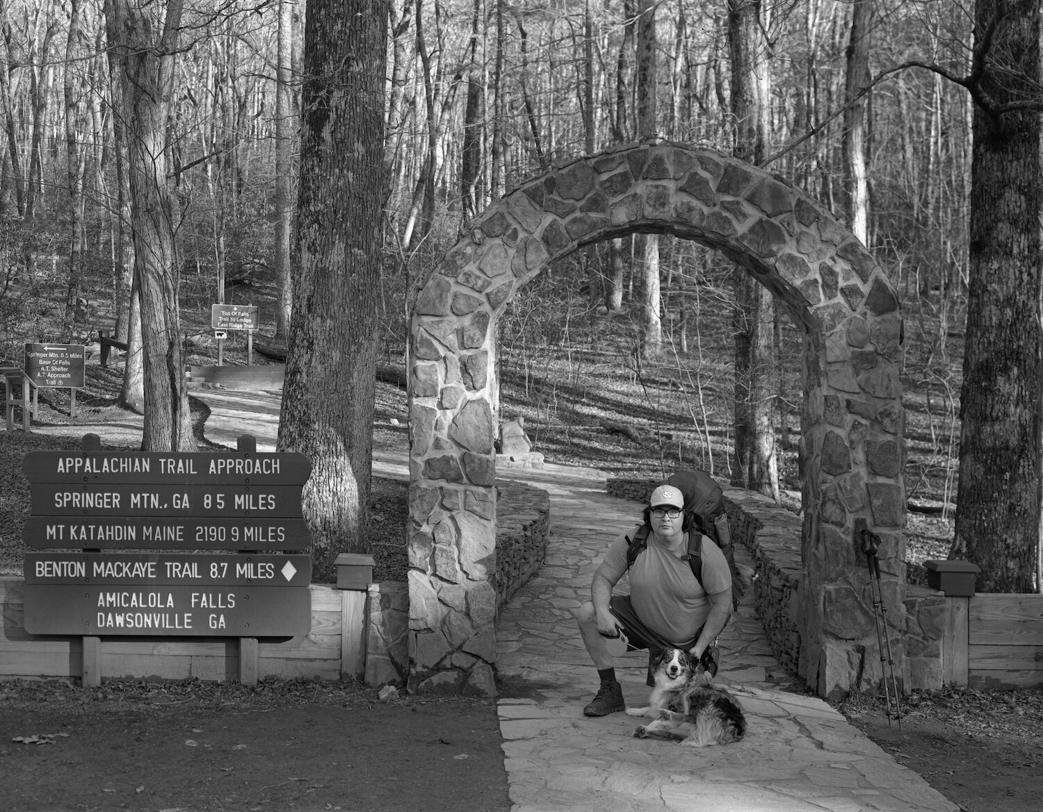
Papa Bear & Care Bear — Amicalola Falls State Park — Georgia — mile -8.5. This is a negative mile because the Appalachian Trail truly begins on Springer Mountain, which is 8.5 miles from Amicalola Falls State Park. In order to get to Springer Mountain, hikers must take the "Approach Trail" beginning in Amicalola Falls State Park to Springer Mountain. Once atop Springer Mountain, their thru-hike officially begins.
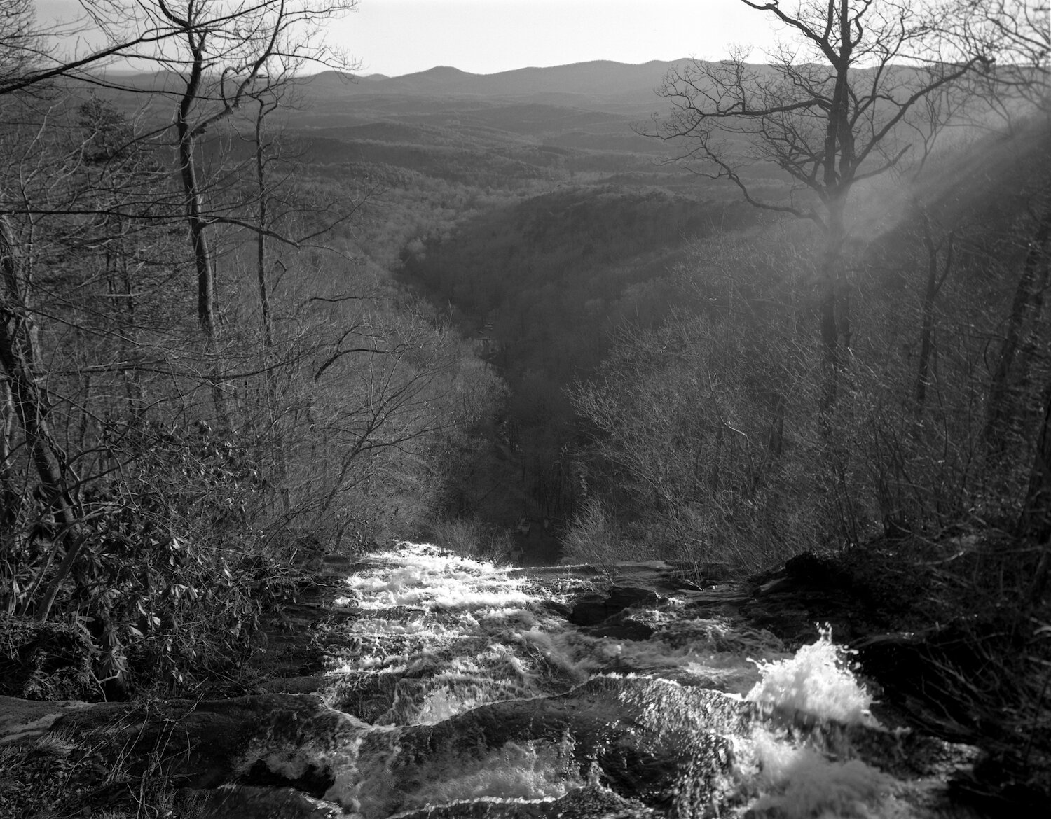
Amicalola Falls — Amicalola Falls State Park — Georgia — mile -7.6
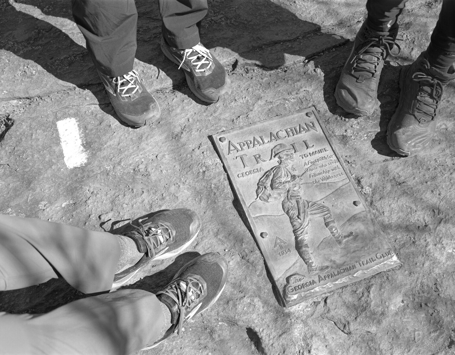
"A Footpath for Those who seek Fellowship with the Wilderness." The summit of Springer Mountain — the Southern Terminus of the Appalachian Trail, where northbound thu-hikers (nobo's) begin their journey from Georgia to Maine — Georgia — mile 0.0
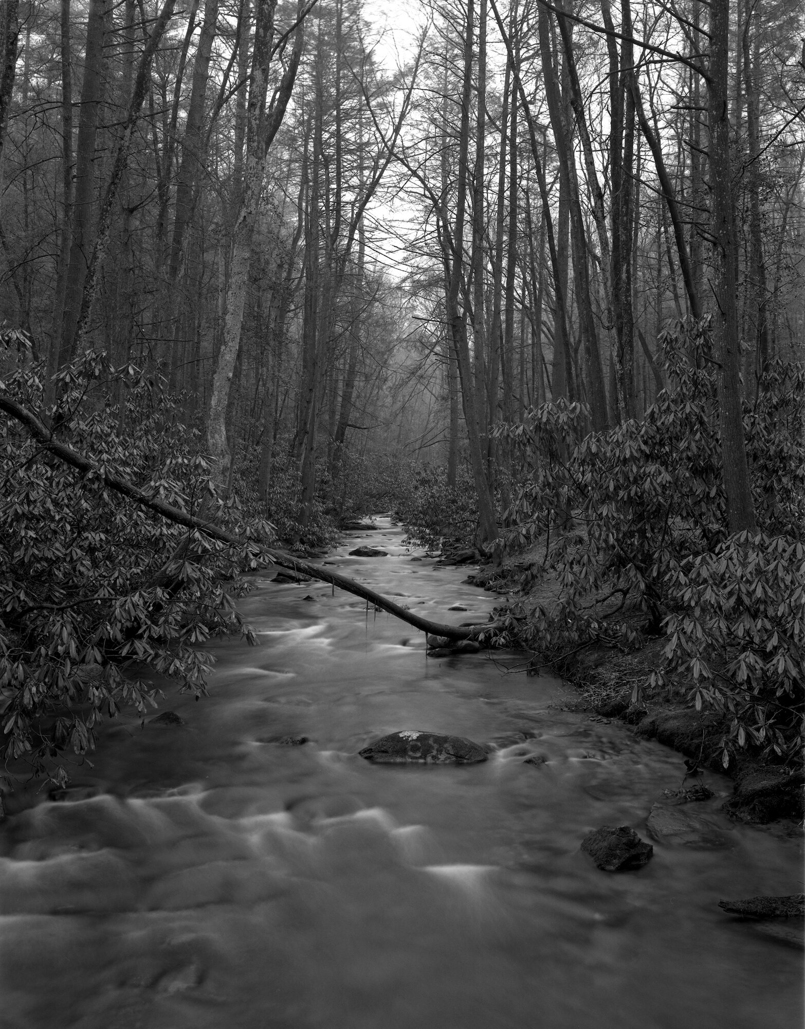
Stover Creek — Georgia — mile 3.8

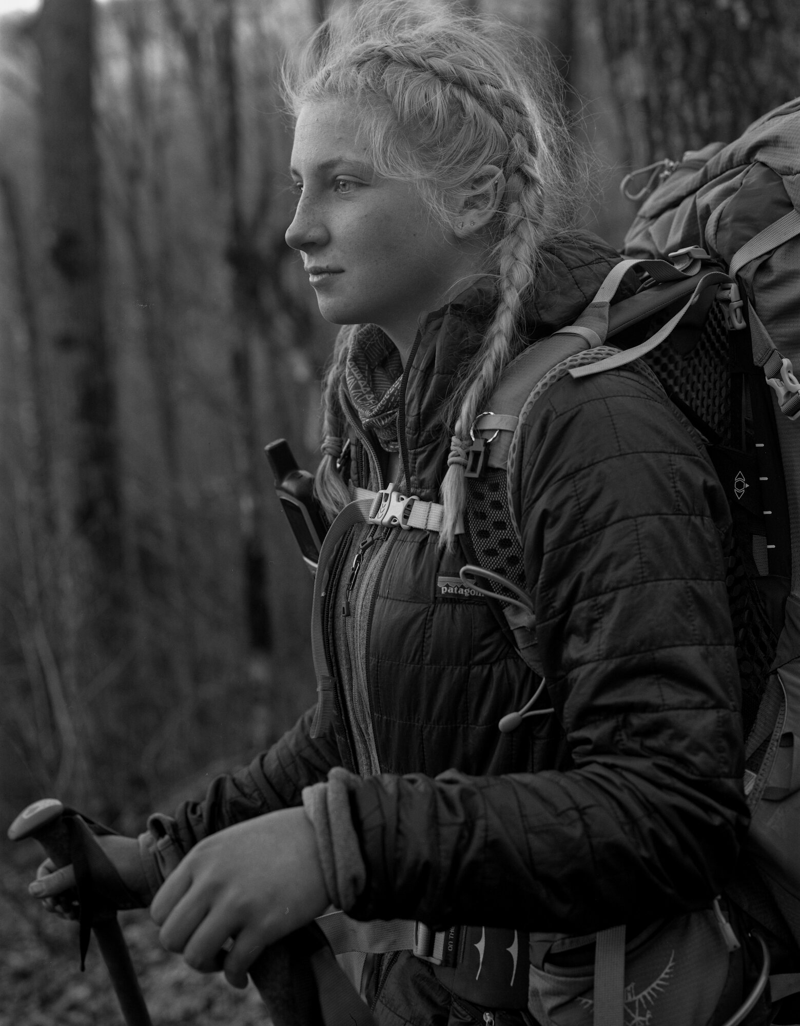
Spicy Brown — Hawk Mountain Shelter — Georgia — mile 8.1
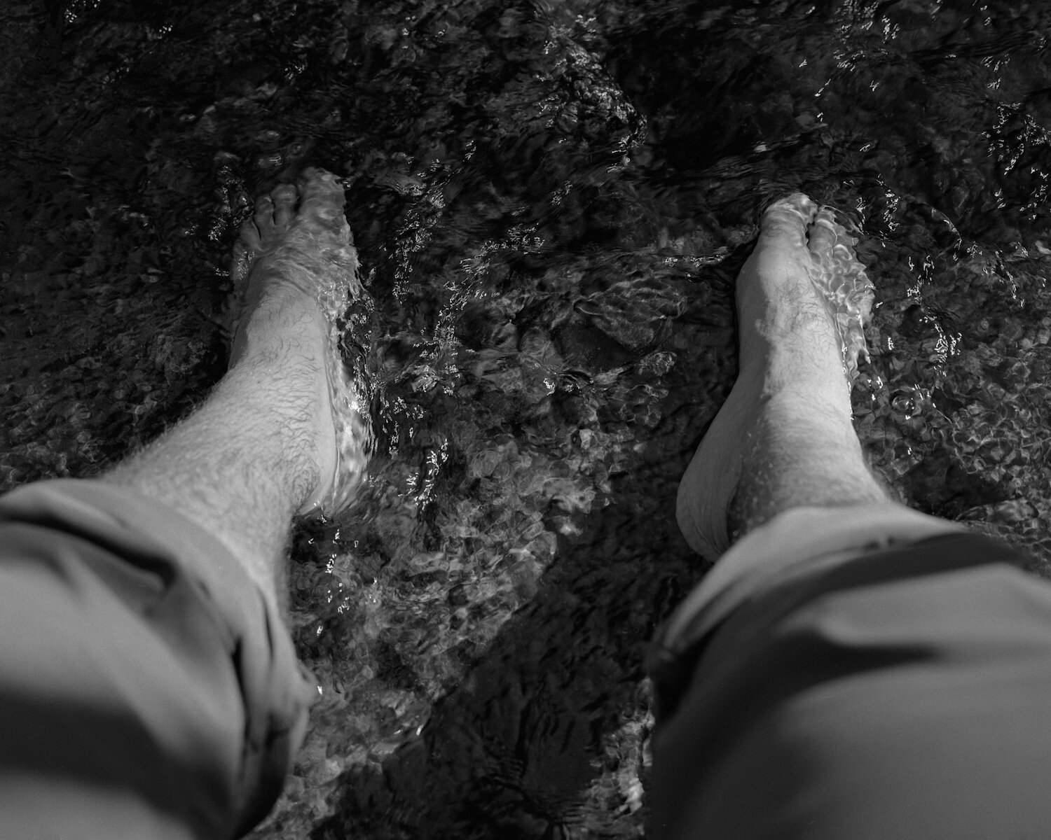
Soaking my swollen feet in Lance Creek — Georgia — mile 23.8
Night Heaver — Jarrad Gap — Georgia — mile 26.2
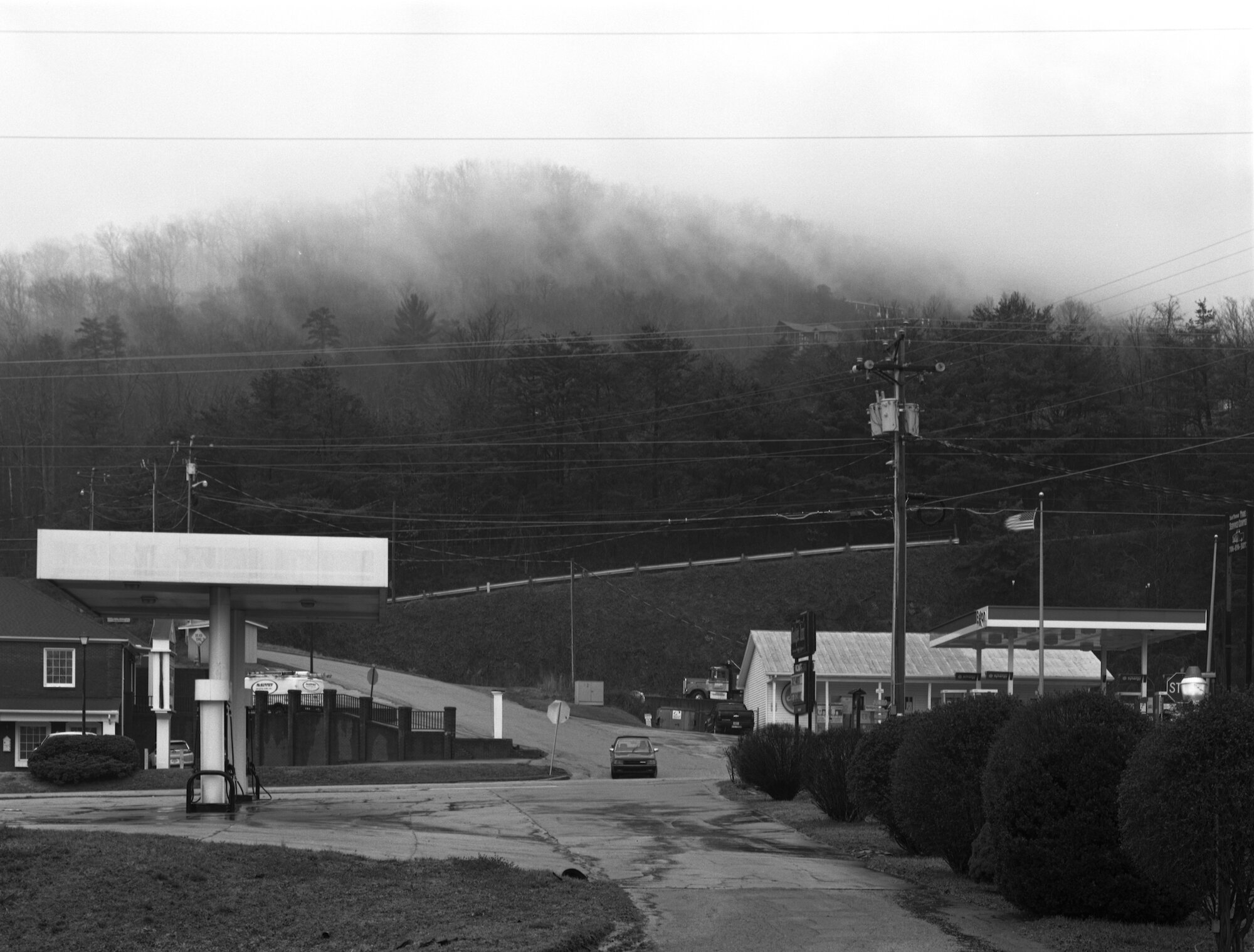
Main Street, Hiawassee, Georgia — accessible from Unicoi Gap — mile 52.5

Rainbow peeing — Georgia — mile 67.6

Cole & Emilie — The Twisted Oak at Bly Gap — North Carolina — mile 78.2

North Carolina — mile 79.8
Catawba Rhododendron atop Standing Indian Mountain — North Carolina — mile 95.3
Pixie — Long Branch Shelter — North Carolina — mile 102.2
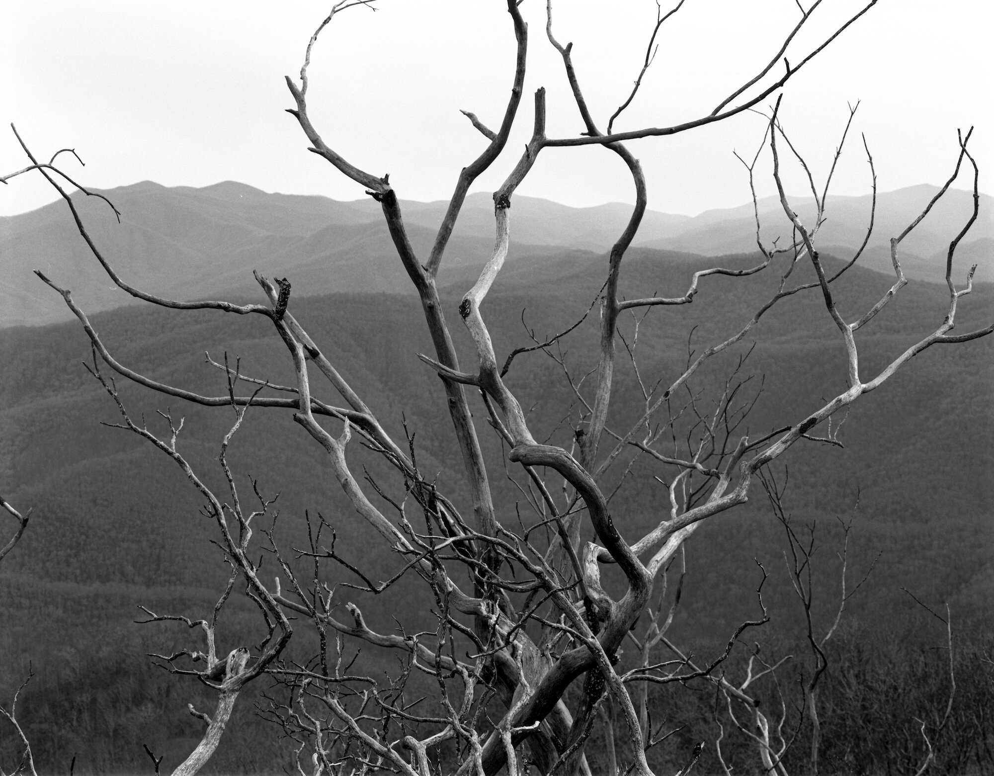
Tree Charred by Forest Fire — Wayah Bald — North Carolina — mile 119.5
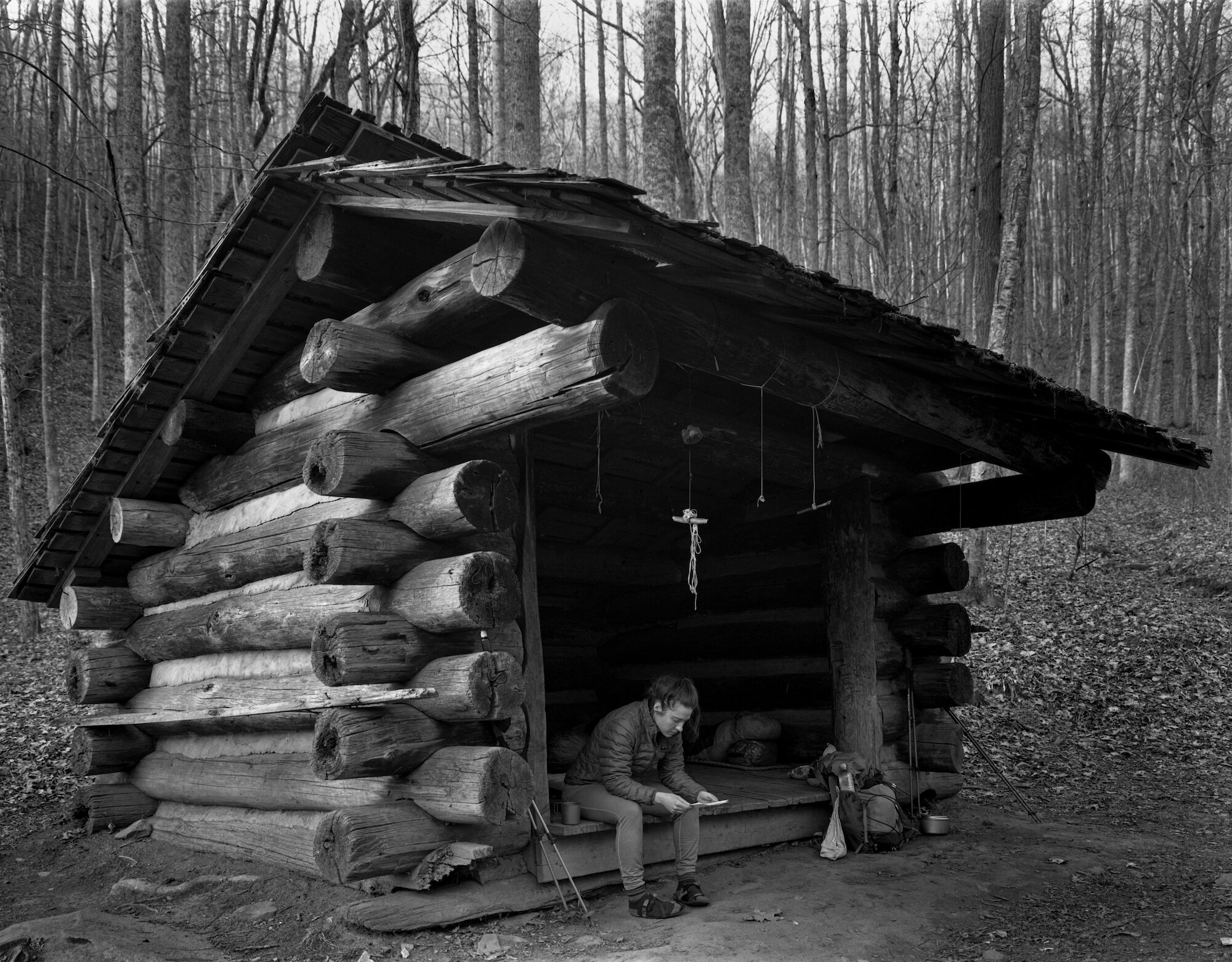
Lauren — Cable Gap Shelter — North Carolina — mile 159.2

Leaf Skeletons — North Carolina — mile 173.7
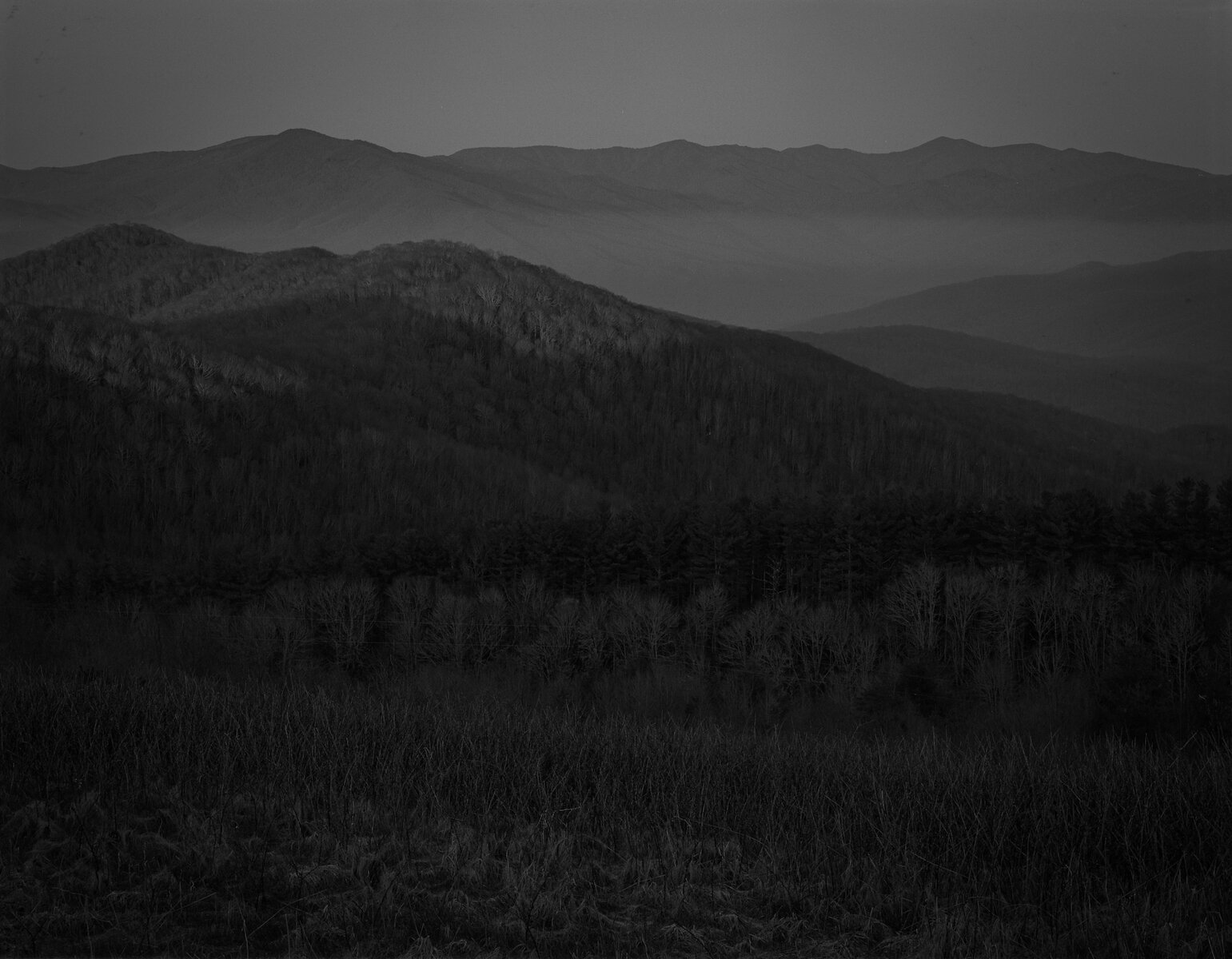
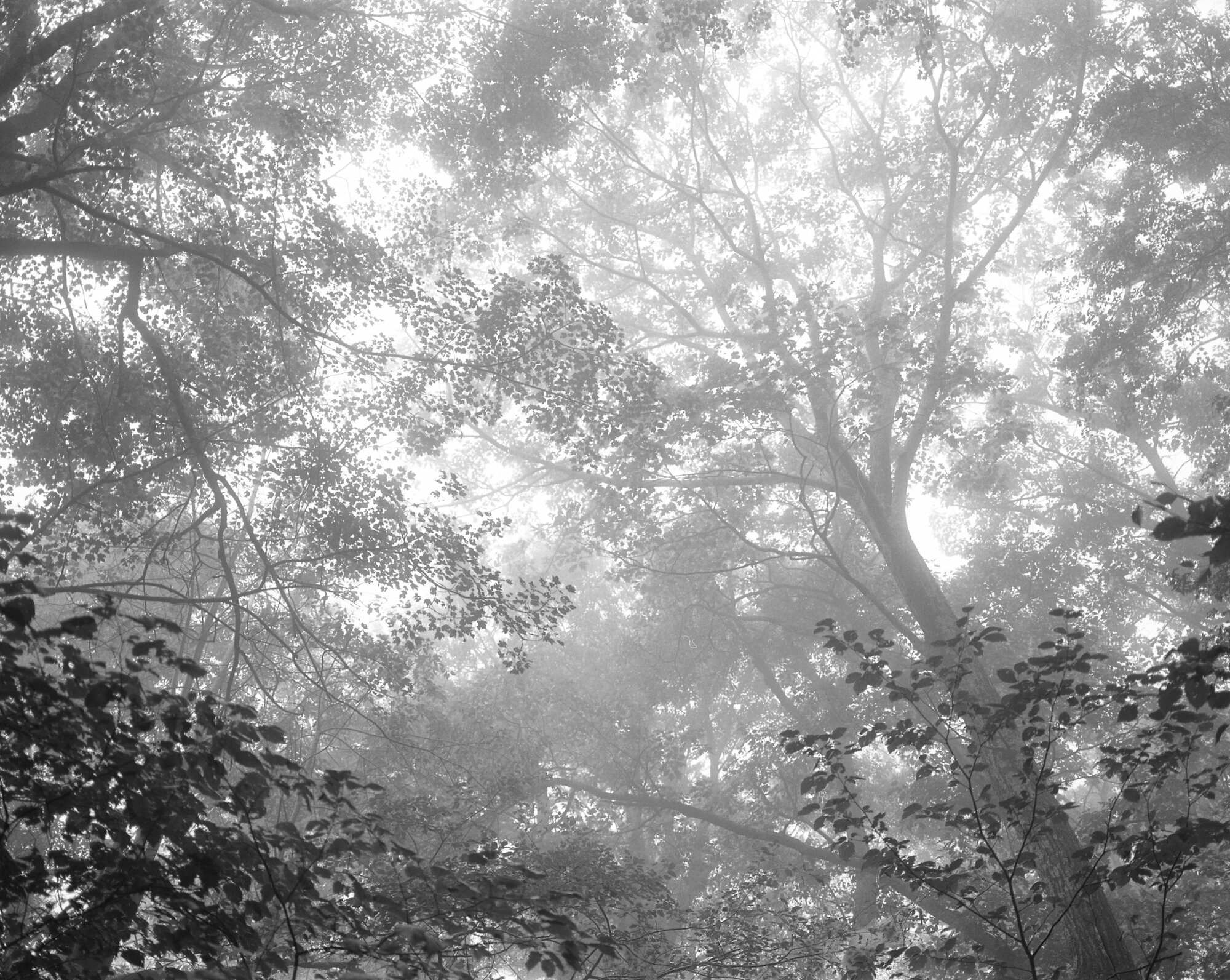
Great Smoky Mountains National Park — North Carolina
Facing West at Sunrise on Max Patch — North Carolina — mile 255.1

Nimblewill Nomad — North Carolina — mile 256.6
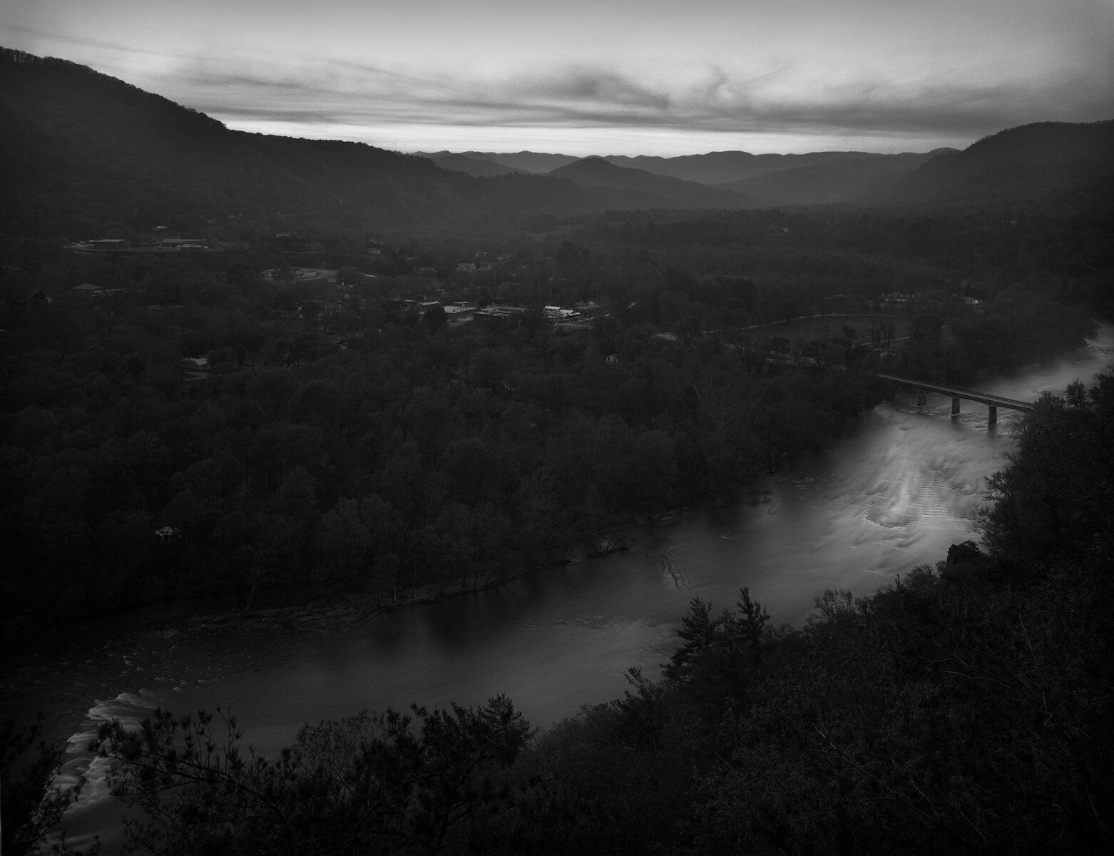
Lovers Leap — French Broad River — Hot Springs, North Carolina — mile 276.2. A Cherokee legend about Lovers Leap says that Chief Lone Wolf who ruled the Tahkiostie River (French Broad River) had a daughter, Mist-on-the-Mountain. He arranged for her to marry an old, powerful man named Tall Pine, but she fell in love with a young, handsome visitor to her village named Magwa. She and Magwa arranged to meet on the rock outcrop overlooking the river, but Tall Pine followed them. In the ensuing conflict, Tall Pine struck and killed Magwa. Mist-on-the-Mountain ran, but Tall Pine trapped her. She then heard Magwa's spirit call to her and she leapt from the cliff into the river. Before Tall Pine could escape he was attacked and killed by a panther.

Shoes — Allen Gap — Tennessee — mile 289.7
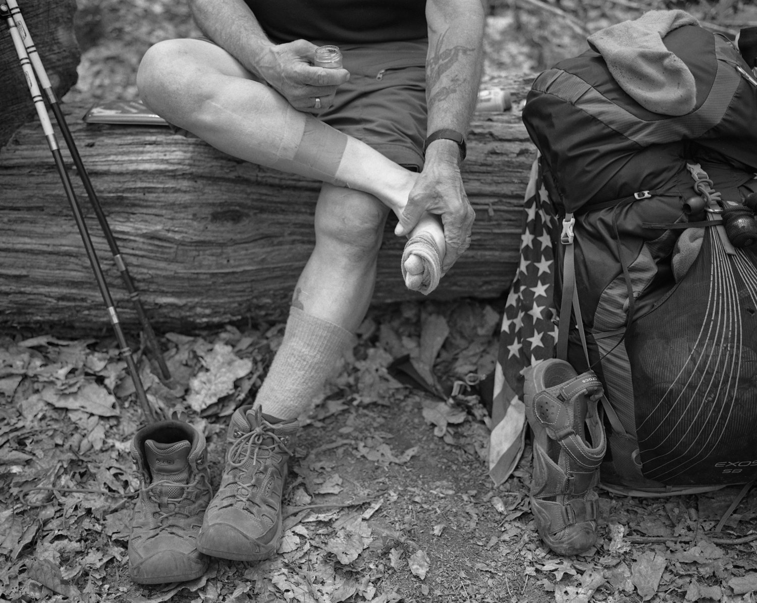
Wanderer applying balm to his feet — Tennessee — mile 292.4

Croc Pot — Tennessee — Mile 330.8
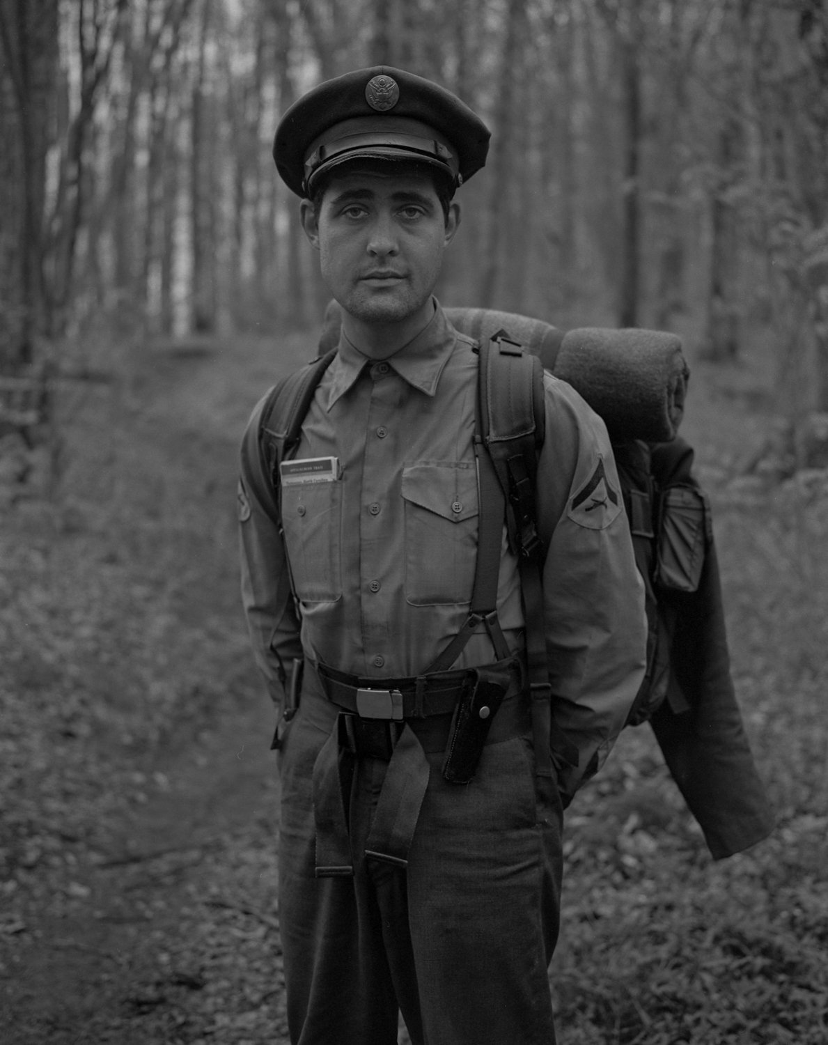
Dough Boy — Cherry Gap Shelter — Tennessee — mile 361.4 — This interesting character was attempting to hike the entire Appalachian Trail wearing his grandfather's uniform from World War II. Earl Shaffer, the first recognized person to hike the entire Appalachian Trail in a single year, came home from World War II and said that he wanted to walk the war out of him. Before the war began, Earl and his friend, Walter Winemiller, had dreamt of hiking the trail together, but then the great war came and they both enlisted. Walter gave his life in service of the country. Upon returning home, Shaffer went on to hike the trail, a feat that was considered impossible at that time, and he photographed his journey along the way to prove he completed the trek. When I met Dough Boy on the trail, I earnestly wondered if this was the ghost of Walter Winemiller that had come to meet me on my journey.

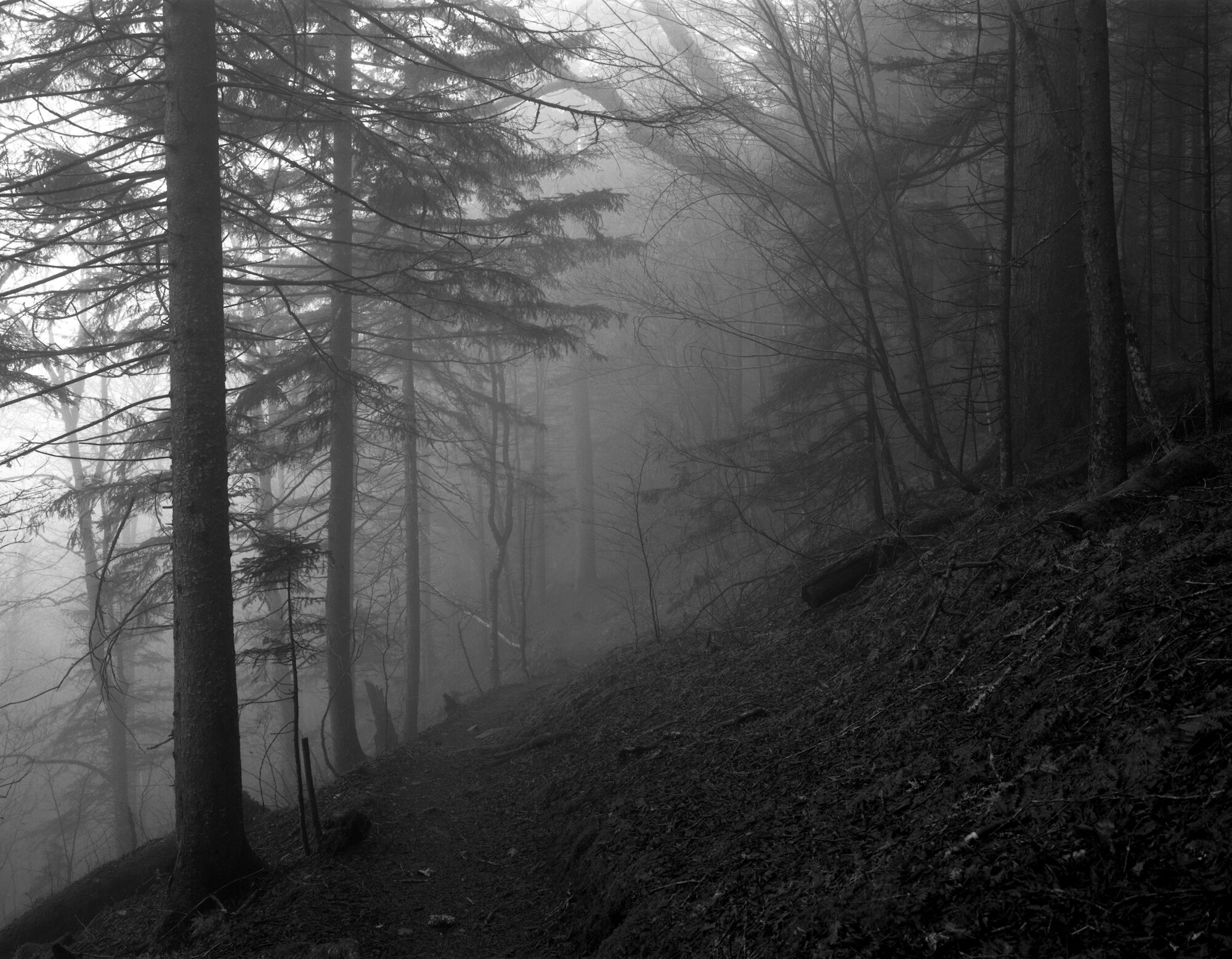
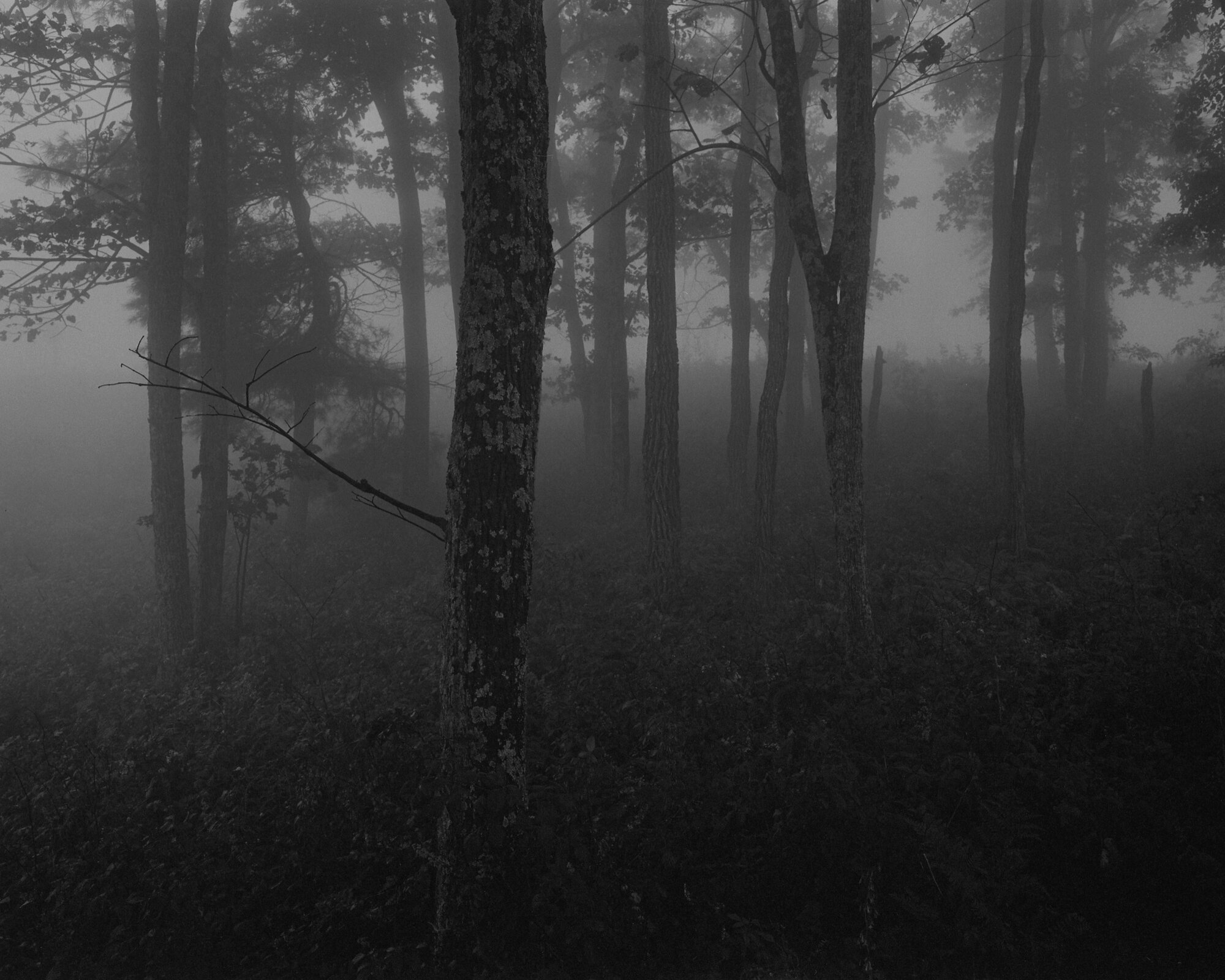
Rain and Fog — Tennessee — mile 365.9
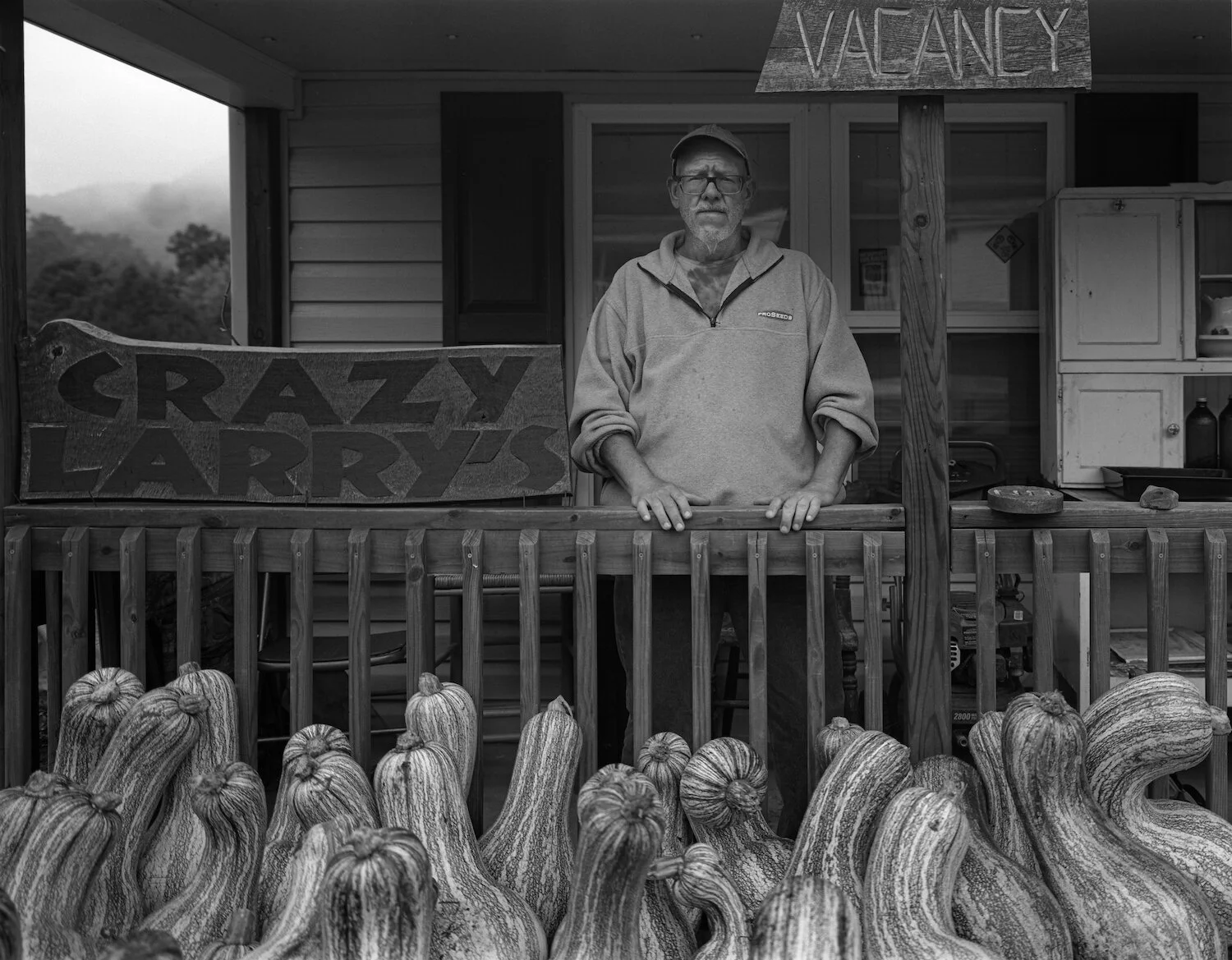
Crazy Larry - Crazy Larry's Hiker Hostel - Damascus, Virginia - mile 471.1

Bear Claw - Crazy Larry's Hiker Hostel - Damascus, Virginia - mile 471.1
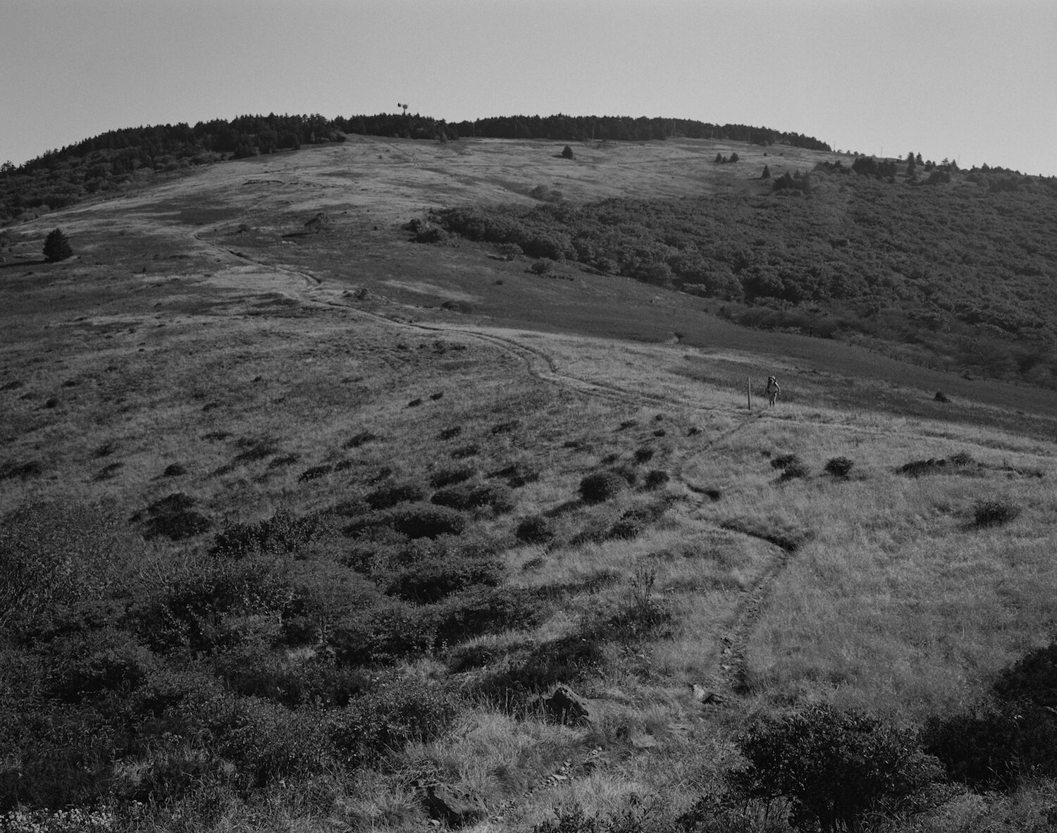
Standing atop Buzzard Rock viewing the Summit of Whitetop Mountain - Virginia - mile 491.5. Whitetop Mountain is Virginia's second tallest mountain at a height of 5,518 feet. Less than ten miles away and also along the Appalachian Trail, Virginia's tallest mountain at 5,728 feet is Mount Rogers.
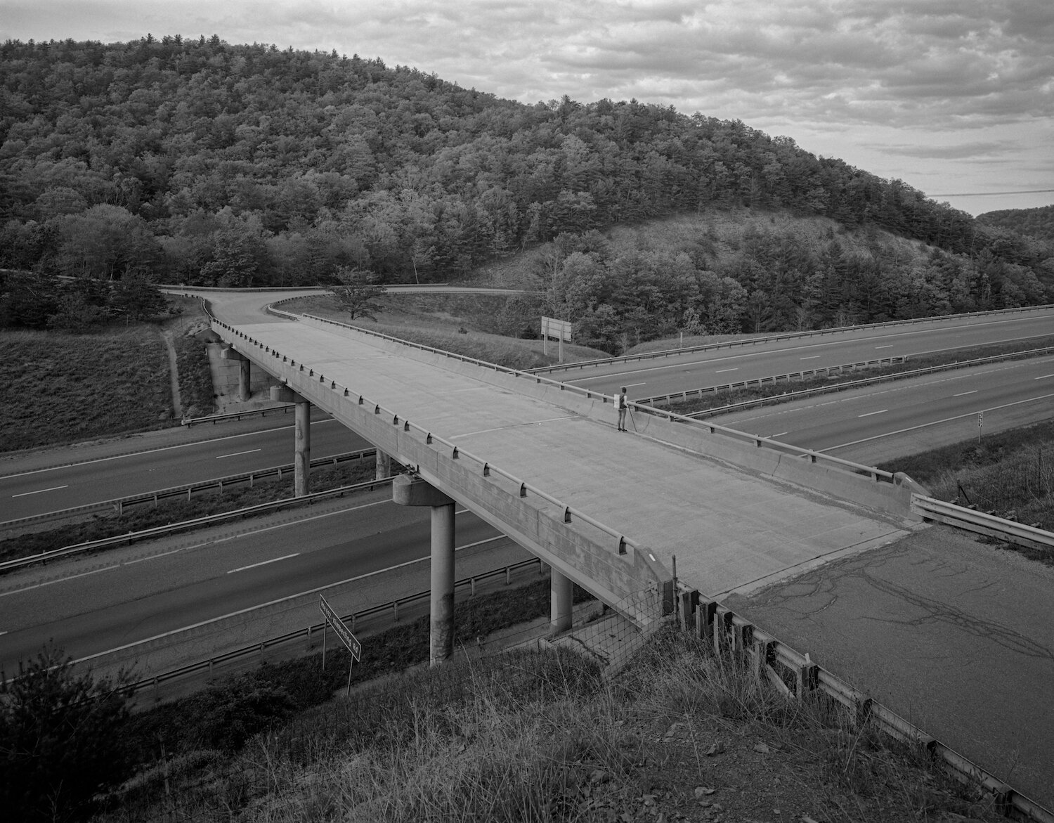
Crossing over Interstate 77 on VA Route 612 — Virginia — mile 592.3

Azalea after rain — Virginia — mile 600.2

Little Pink Lady — Virginia — mile 600.3

Poko aka Pocahontas — Angels Rest Hiker Haven, Pearisburg, VA — accessible from VA Route 100 — mile 637.0

Trail Magic — Virginia — mile 678.5
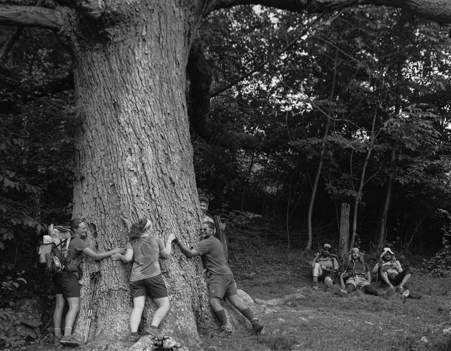
Keffer Oak — Second Largest Tree on the Appalachian Trail — Virginia — mile 678.9

Sam — Dragon's Tooth — Virginia — mile 702.3
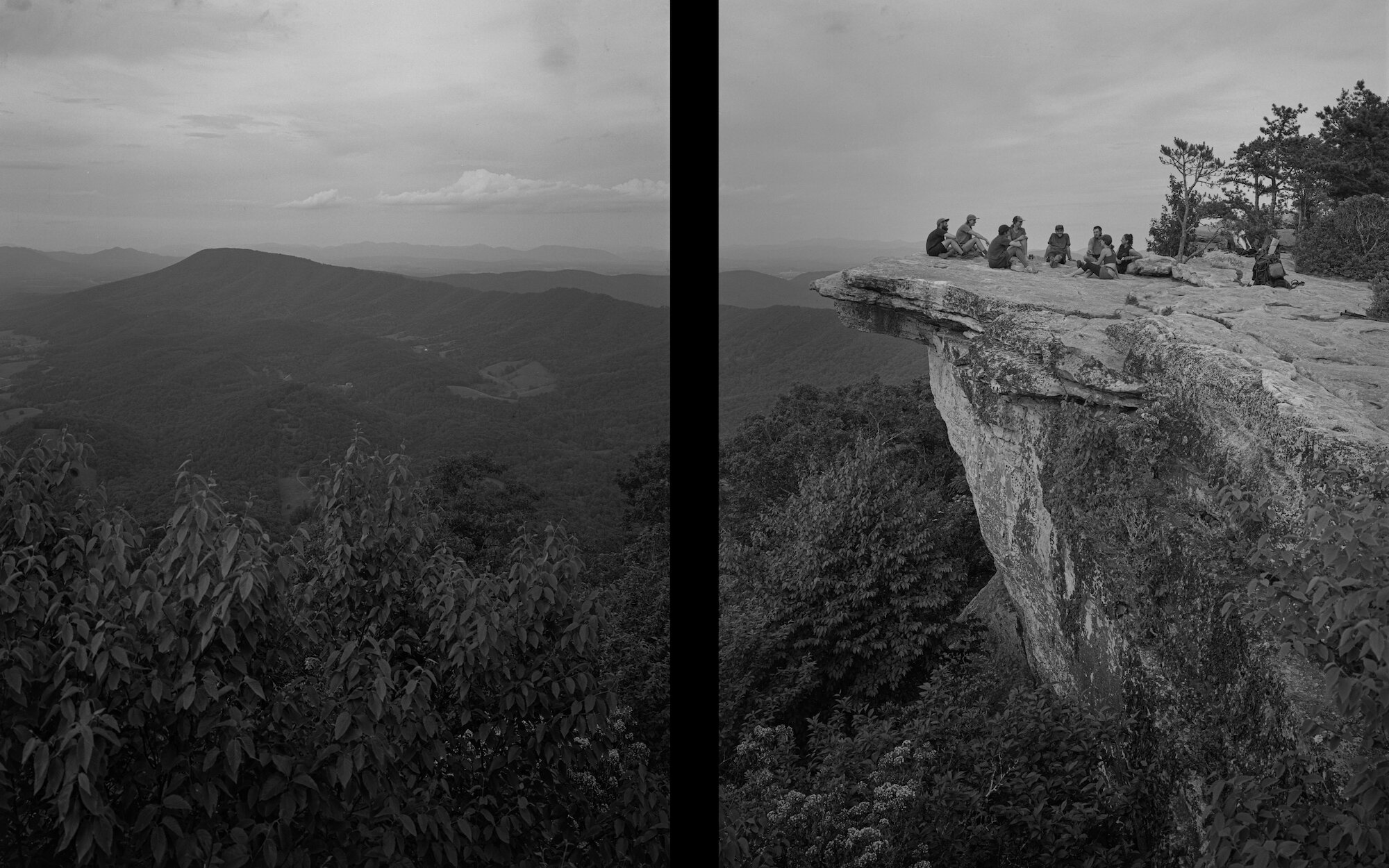
Dinner on McAfee Knob — Virginia — mile 714.2

Squatch & Traffic Light — Howard Johnson Motel, Daleville, VA — accessible from US Route 220 — mile 730.3

Boomhower — Virginia — mile 786.9
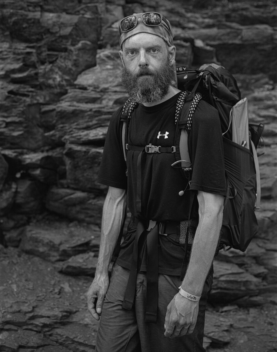
Bull — Virginia — mile 786.9
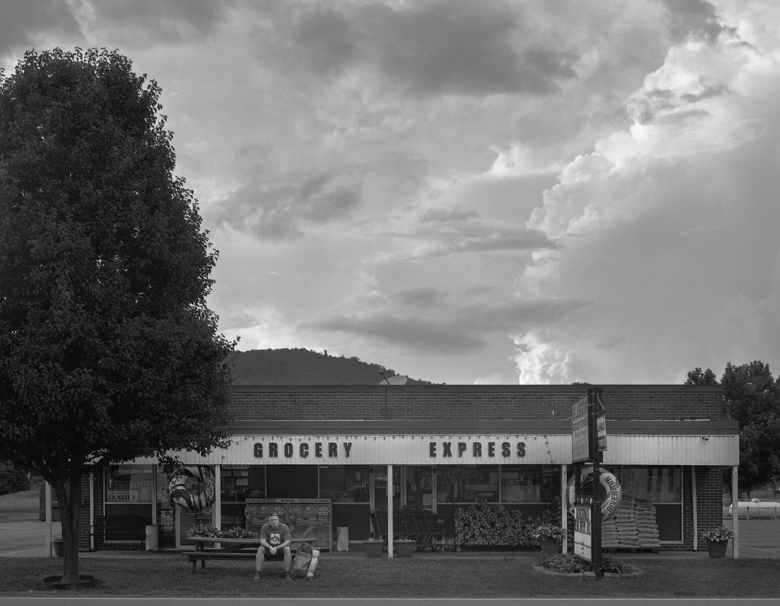
Chives — Grocery Express, Glasgow, VA — accessible from US 501 — mile 787.3

The Book of Confessions — Priest Mountain Shelter — Virginia — mile 829.7

Crabman & Rocket — Virginia — mile 864.6
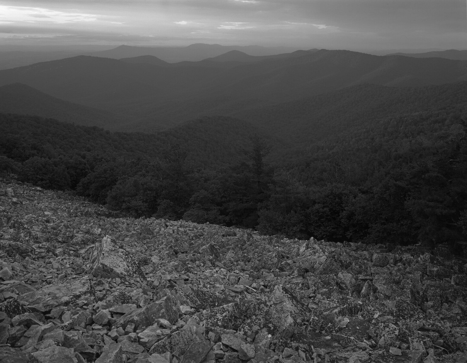
Blackrock Vista — Virginia — 885.5
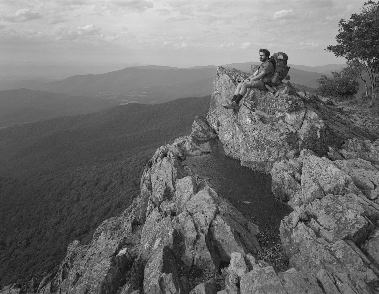
Quickdraw — Little Stony Man Vista — Virginia — mile 936.0

Noodle & Honey Badger — Open Arms Hostel, Luray, VA — accessible from Thornton Gap, US Route 211 — mile 944.4
Jewell Hollow — Virginia — mile 939.4
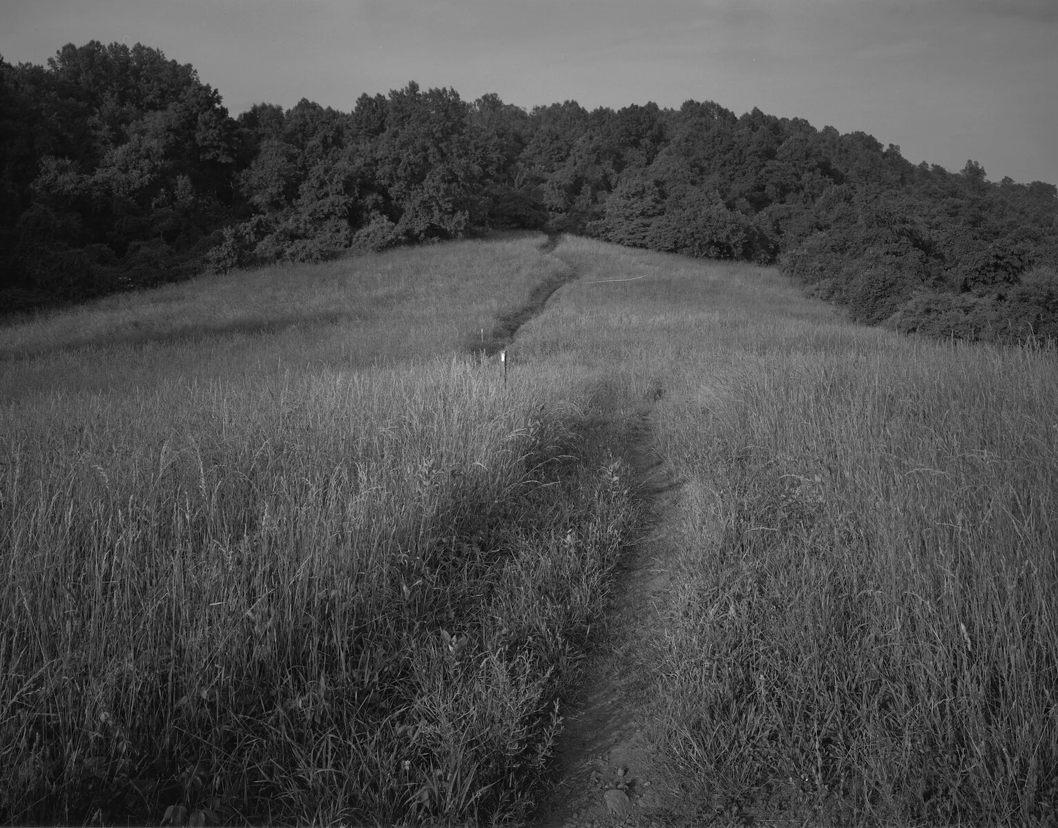
Virginia — mile 979.1
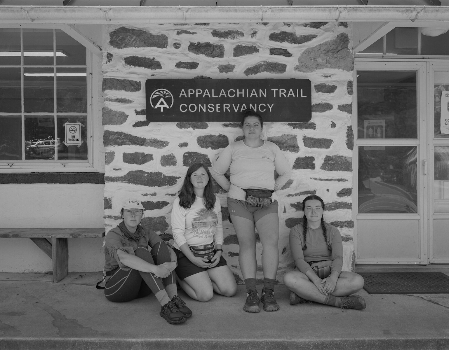
Phantom, Birdie, Lowrider & Sparky — Appalachian Trail Conservancy Headquarters, Harpers Ferry, WV — mile 1025.4

Maryland Heights Overlook viewing Harpers Ferry, WV, the Goodloe E. Byron Memorial Pedestrian Walkway, and the Confluence of the Shenandoah and Potomac Rivers. The footbridge across the Potomac marks mile 1026.1. Note — the Maryland Heights Overlook is not accessible from the Appalachian Trail. However, it provides the clearest view of the trail town of Harper's Ferry and the pedestrian walkway, which constitutes the part of the Appalachian Trail that crosses the Potomac River.

"Regret Nothing" — Optimist — Delaware Water Gap, PA — mile 1296.0

Guinea Brook — Connecticut — mile 1481.4

Will — Pine Knob — Connecticut — mile 1483.4

Sunrise near Belter's Campsite — Connecticut — mile 1492.7
Connecticut — mile 1492.7
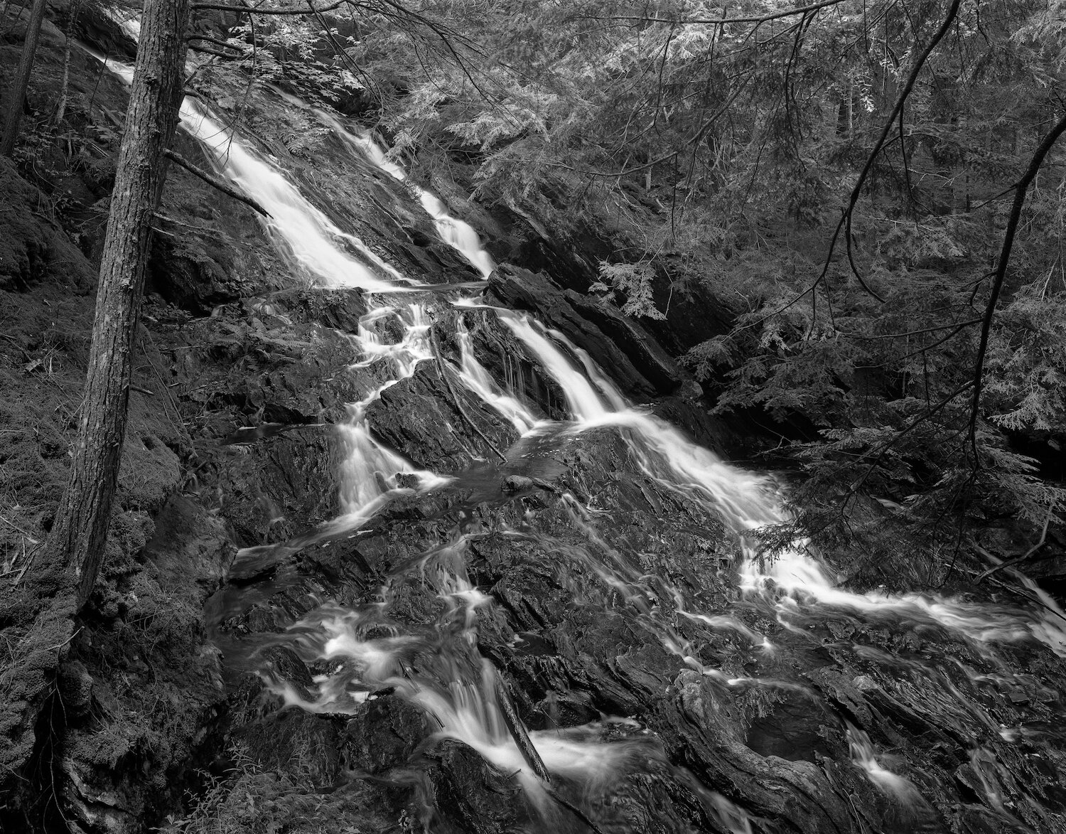
Waterfall — Giant's Thumb — Connecticut — mile 1499.1

Amanita bisporigera aka the Destroying Angel — most poisonous mushroom found along the Appalachian Trail — Massachusetts — mile 1519.7
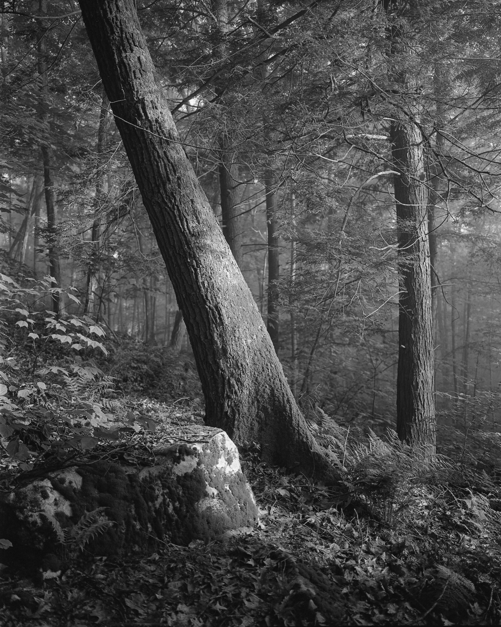
Massachusetts — mile 1527.7
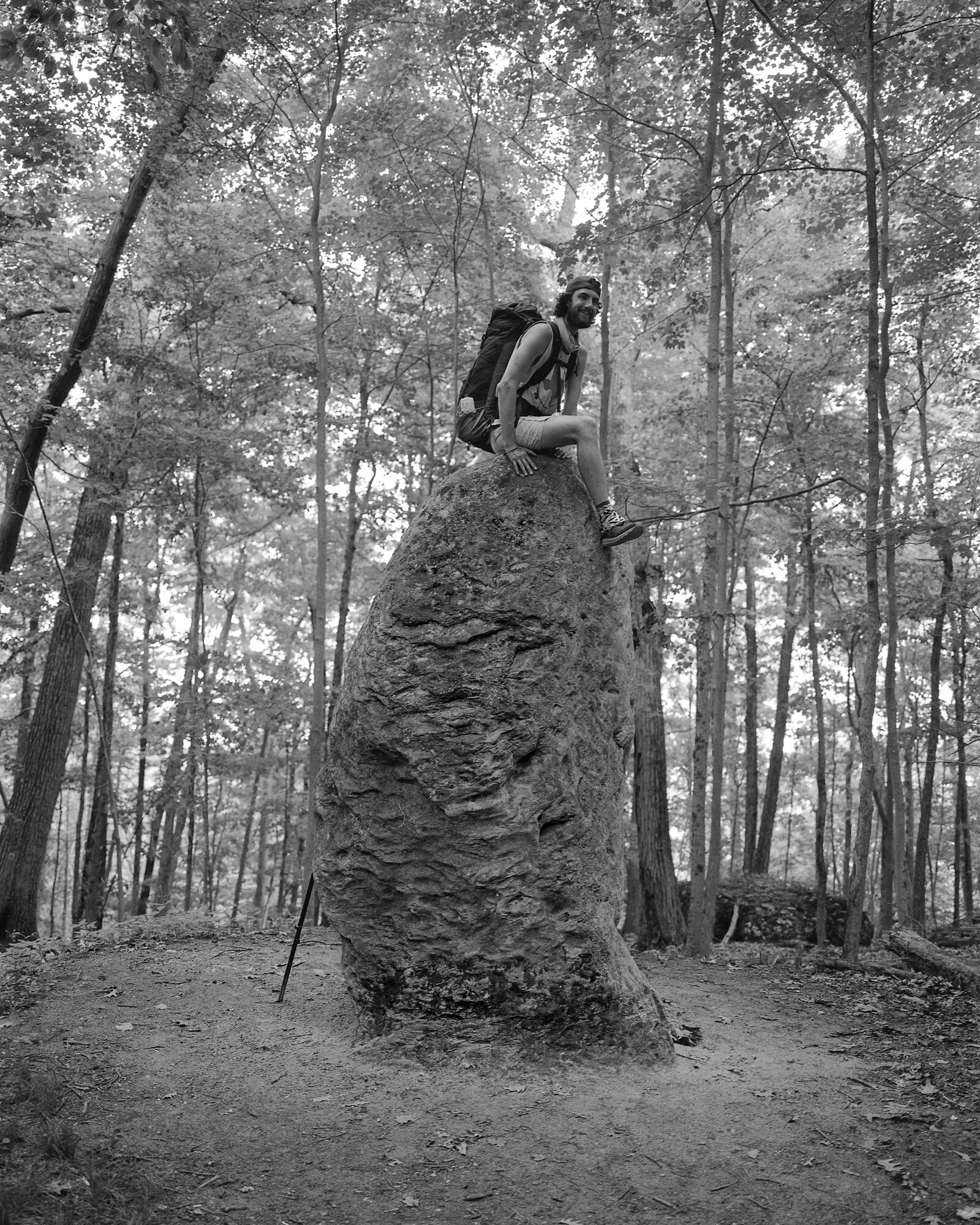
Massachusetts — mile 1530.3
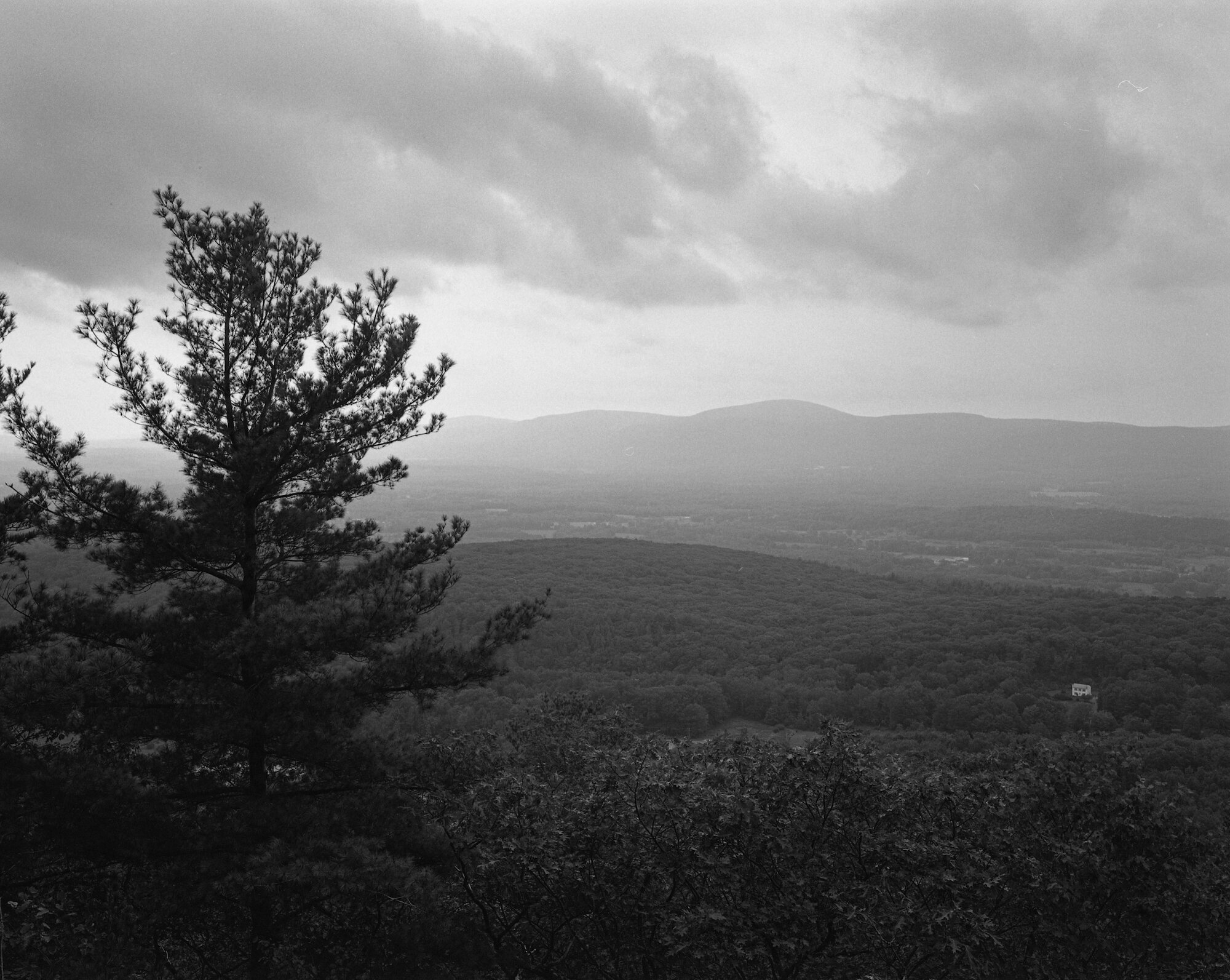
Massachusetts — mile 1536.3

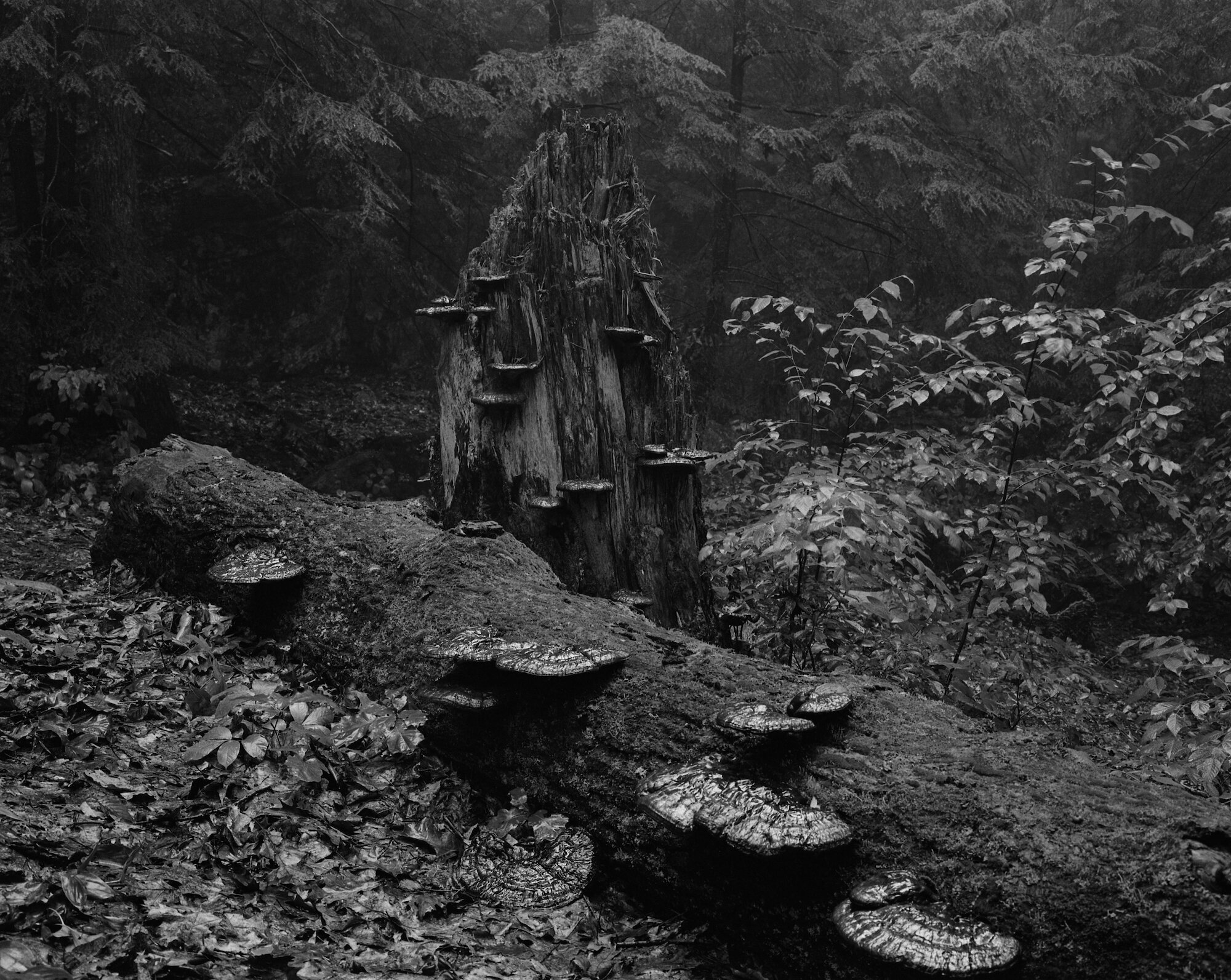
Massachusetts — mile 1542.5

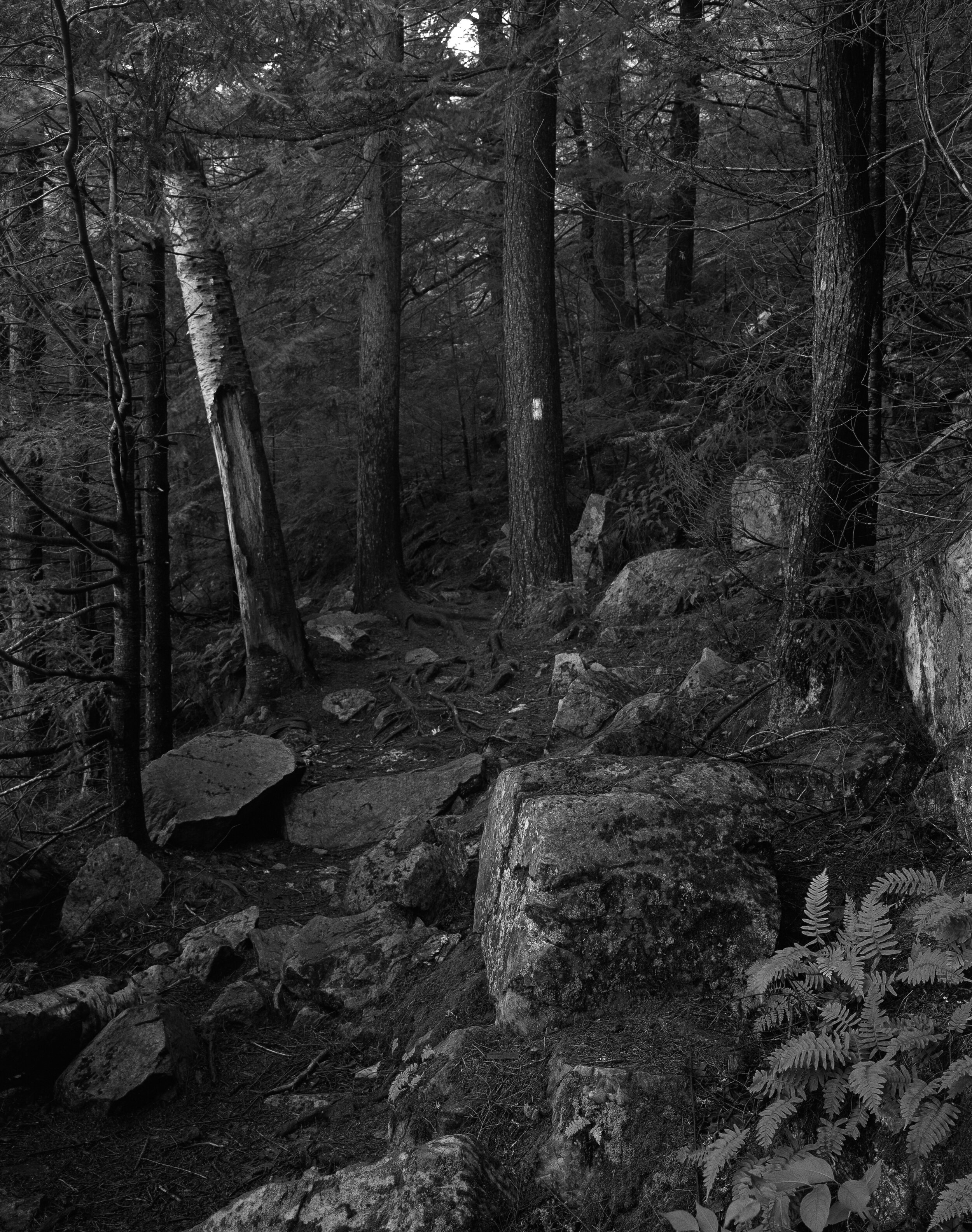
Clear Cut — near Washington Mountain Road — Massachusetts — mile 1562.0

Puppy — Mark Noepel Shelter — Massachusetts — mile 1585.9
Along the eastern side of Little Rock Pond — Vermont — mile 1674.0
Thundering Falls — Vermont — mile 1709.5